The observations compiled here reflect a shared commitment among Tribes, local governments, landowners, state agencies, nonprofits, and technical experts. Floodplains by Design is grateful to every partner who helped plan, design, construct, monitor, and steward these projects, and to those who responded during the storms to protect lives and property. Many project partners and the greater integrated floodplain management network shared inspiring examples of how long-term mitigation work showed up during the December 2025 floods.
King County
Lower Russell Levee Setback City of Kent
The Lower Russell Levee Setback on the Green River performed exactly as designed. Floodwaters stayed fully contained within the setback levee and floodplain with room to spare. This project gave the river space to spread out and slow down while reducing pressure on downstream infrastructure.
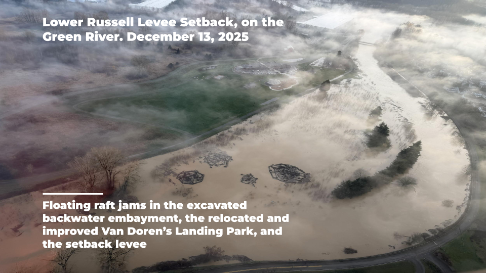
(Photo Courtesy of King County)
Community members often go out of their way to tell me how much they love the project, including the relocated and improved Van Doren’s Landing Park, trails, and natural areas (constructed habitat), and often thank me for my work on the project! Project partners are proud of the project and happy with the outcome, including the City of Kent (both Parks and Public Works), Muckleshoot Indian Tribe, and WRIA 9.
Yakima County
Naches River N9 Setback
In Yakima County, the Naches River reached its third-highest recorded stage and stayed high for nearly two weeks. At the N9 Setback site, previously removed levees and newly connected floodplains absorbed the majority of the flow that otherwise would have attacked the opposite bank. Flood fighting across the opposite bank was not required, reducing stress on staff, emergency response needs, and public safety risks. As one local partner reflected afterward, the reduced need for overnight monitoring, emergency response hours, and flood anxiety made the value of integrated floodplain management unmistakably clear.

(Photo from "A Tale of Two Levees", a StoryMap by Yakima County Flood Control Zone District)
It sure was nice only having to check a handful of spots in the middle of the night thanks to all of the integrated floodplain management work done in Yakima County. That hit me pretty hard. Just the reduced worrying and mental stress, and staff hour reduction, reduction in vehicle mileage and fuel. It all adds up and really sank in last night.
Clallam County
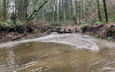
Lower Dungeness River Floodplain Restoration Project
During the flood event, the river flowed into its historic floodplain, spreading out across more than 50 acres of restored wetland and side channel habitat. Water slowed and dispersed across the reconnected floodplain rather than remaining confined in a narrow corridor. The restored “Schoolhouse Channel,” which reactivated during high flows, is now functioning as a primary side channel. ESA-listed Chinook, summer chum, and steelhead have been observed spawning there, along with pink and coho salmon. ESA-listed trumpeter swans have also been documented using the new floodplain habitat. By reconnecting the river to its historic floodplain, the project increased flood storage capacity, buffered downstream impacts, and created long-term ecological benefits. The result is a system that absorbs flood energy more naturally while supporting fish, wildlife, and the surrounding community.

(Lower Dungeness River Floodplain Restoration Project during the December 2025 floods. Photo Courtesy of Clallam County)
I recently heard from residents that because of the flood water being contained and slowed down by the levee setback project that they didn’t observe flooding downstream as they had before the project.