")
Matt Baerwalde is the Senior Environmental Policy Analyst for the Snoqualmie Indian Tribe in Western Washington State. He joined the Snoqualmie Tribe’s Water Program in 2008, and holds a B.S. in Conservation Biology and a certificate in Wetland Science and Management from the University of Washington, and a B.A. in Philosophy from the College of Charleston. Matt represents the Tribe by engaging in and bringing scientific understanding to local and regional environmental policy issues while also working to implement restoration, protection, and research projects. He has successfully secured and helped manage millions of dollars in grant funds from a variety of sources for habitat and water quality restoration, protection, research and monitoring projects occurring both on and off the reservation.
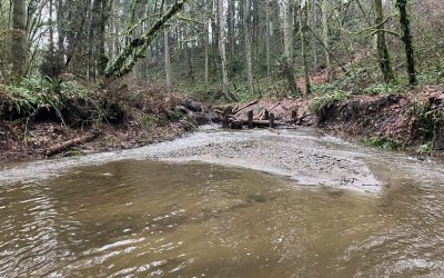
In a collaborative effort, the Snoqualmie Indian Tribe’s Environment and Natural Resources Department, EPA Office of Research and Development, and EPA Region 10, deployed the Visualizing Ecosystem Land Management Assessments (VELMA) watershed model to the Tolt River; ancestral lands vital to the Tribe’s identity and central to Puget Sound salmon recovery. The joint study is a unique look at how restoration strategies in upland forests and floodplains can enhance streamflows, reduce water temperatures, and strengthen climate resilience.
The project applied EPA’s VELMA ecohydrological model and Penumbra solar-shading model to simulate how forest and riparian restoration practices affect water flows and stream temperatures critical to salmon recovery. The full technical report, “Modeling Floodplain and Watershed Restoration for Salmon Recovery in the Tolt River Watershed”, was co-authored by Tribal and federal scientists. To expand on the data and deepen the collaboration behind the work, Baerwalde participated in a supplemental interview to share how the Tribe’s Indigenous knowledge is shaping restoration decisions.
“The Tolt River is one of the most important places for Snoqualmie people,” said Baerwalde, Senior Environmental and Natural Resources Policy Representative for the Tribe. “One of our main villages was right at the confluence. This work is a part of our responsibility to care for it.”
Modeling for a Better Future
Visualizing Ecosystem Land Management Assessments (VELMA) allowed the Snoqualmie Tribe to compare alternative land-use and restoration scenarios. One of the most striking findings: streamflows during summer flow months (July – October) could have been 20% to 60% higher in 2010 if historical forest management had favored selective thinning over industrial clearcutting. The VELMA-Penumbra simulations yielded powerful insights:
-
- Riparian forestation has the potential to increase floodplain soil and groundwater shading by up to 44% by the year 2100, enhancing cold-water refuges for salmon
-
- These cooler zones could be 2-6C colder than surrounding river temperatures in late summer. A critical benefit during salmon migration and rearing.
-
- If historical logging in the upper watershed had used thinning instead of clearcutting, summer flows could have been 20-60% higher during key spawning months in 2010.
-
- Forest thinning also showed minimal increases in peak flows, suggesting its viable restoration strategy for boosting streamflow without worsening flood risks.

(Tolt River steelhead by J. Glasgow, Wild Fish Conservancy)
How Uplands Shape the Lowlands
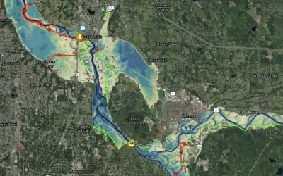
What happens in the uplands doesn’t stay there. The study showed that land management practices, especially in forests, have downstream impacts on hydrology and river temperatures. Tree species, age, and density all influence how much water infiltrates the soil, recharges groundwater, and flows to streams throughout the year.
The VELMA model revealed how integrated strategies such as combining upland forest thinning with riparian restoration, could create big wins: increased streamflow, better temperature control, and enhanced watershed resilience.
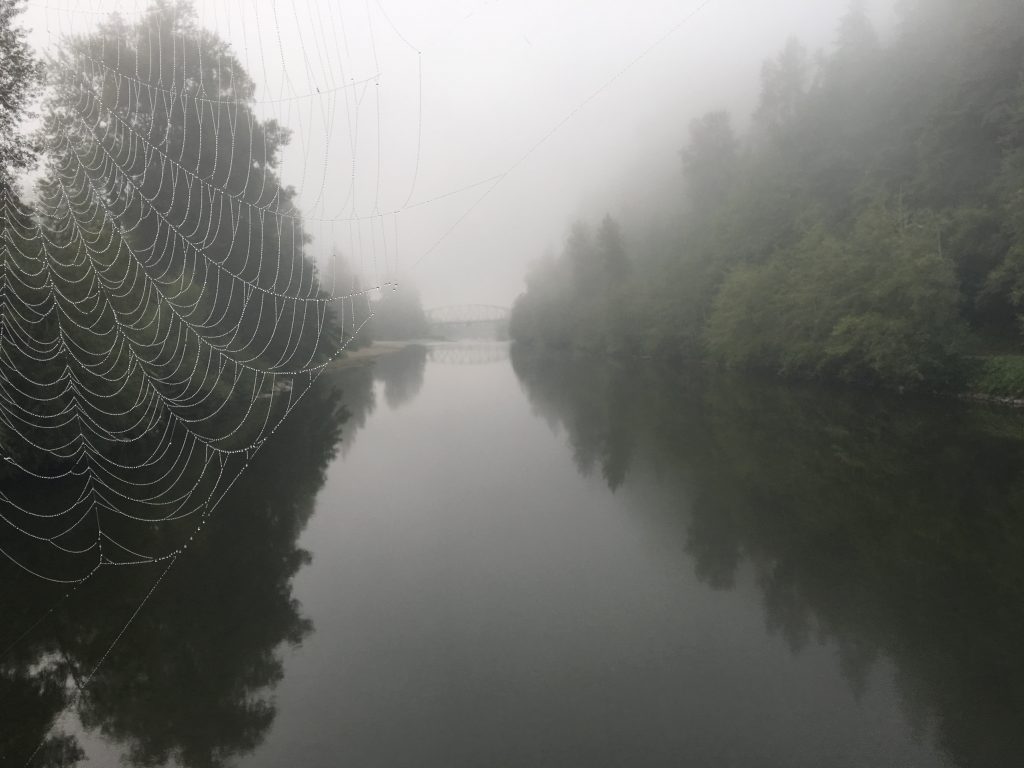
(Snoqualmie River and Tolt River Confluence captured by Matthew Baerwalde)
Indigenous Knowledge as a Framework
While the modeling tools are powerful, Baerwalde emphasized that this project was equally rooted in Indigenous knowledge and science.
“This isn’t just about metrics,” he said. “Our work is guided by generations of knowledge about how these lands and waters connect. We are trying to braid that with Western science. Not just to include it, but to let it lead.” – Matthew Baerwalde
That perspective shaped the questions asked in the study. Shifting the focus from isolated fixed to full watershed health. Where others might ask, “How do we restore this stream?” Baerwalde asks, “How do we restore our relationship with this river?” For the Tribe, that means looking beyond the riverbanks and into the full watershed: connecting upland forest practices, traditional village sites, water rights, and cultural lifelines with today’s data and decision-making frameworks.
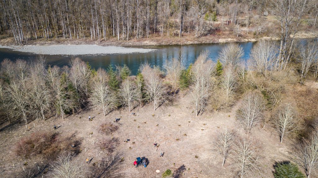
Photo courtesy of the Snoqualmie Tribe
A Model for More than One River
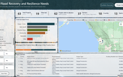
The EPA and Snoqualmie Tribe report doesn’t just model flows. It models a way forward for other communities. The report outlines how the VELMA model can help other communities prioritize limited resources and weigh the tradeoffs of restoration options. Should funds go to buying and restoring floodplains? Or toward upland forest thinning and road decommissioning? VELMA helps make those decisions more informed and defensible.
The collaboration with EPA set a strong example for how federal agencies can align to produce tools that serve both cultural and ecological restoration. It proves that when landowners, agencies, and tribes collaborate, they can identify the most effective actions to support climate resilience and salmon survival.
“These big projects take time and resources,” Baerwalde said. “The only way they happen is when salmon recovery and flood resilience are aligned.” – Matthew Baerwalde
This project is a strong example of what alignment can look like: culturally grounded, scientifically rigorous, and future-looking.
What’s Next for the Tolt
The Snoqualmie Indian Tribe completed a detailed assessment of the North Fork Tolt River with support from King County grants, gathering baseline data on water quality and hydrology. They are now developing conceptual restoration actions for future implementation, guided in part by VELMA’s insights.
Meanwhile, work continues downstream. The Snoqualmie Indian Tribe is maintaining restored floodplain areas near the river’s confluence, while King County and other partners pursue new levee setback projects. With the City of Seattle also relicensing its hydroelectric dam on the South Fork Tolt, there’s more activity in the watershed now more than ever.
“This study gives us the tools to make smarter choices,” Baerwalde said. “But more than that, it reminds us that this river still has a future and so do the salmon, forests, and people connected to it.” – Matthew Baerwalde
Resources Shared
- Visualizing Ecosystem Land Management Assessments (VELMA) Model
- Penumbra: A spatially distributed mechanistic model for simulating ground-level incident solar energy across heterogenous landscapes
- Modeling floodplain and watershed restoration for salmon recovery in the Tolt River Watershed – A Snoqualmie Tribe and U.S. EPA collaborative effort